The Red Rock Route: Bikepacking Utah
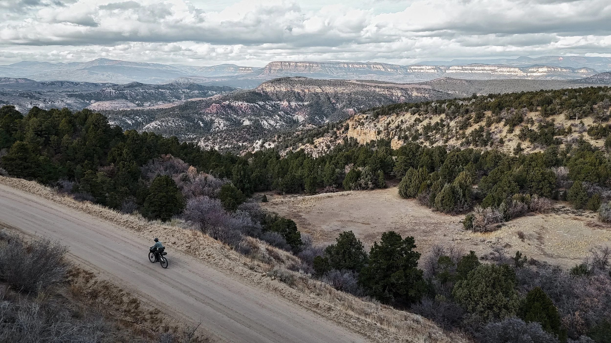
The Red Rock Route is a monumental 700-mile dirt crossing that traverses the geological wonderland of Southern Utah. Linking the iconic slickrock of Moab with the towering plateaus of the Grand Staircase and Zion, the Red Rock Route connects a number of existing bikepacking routes, providing access to no less than five national parks, and offering a challenging passage through some of the most remote and visually arresting landscapes in the American West.
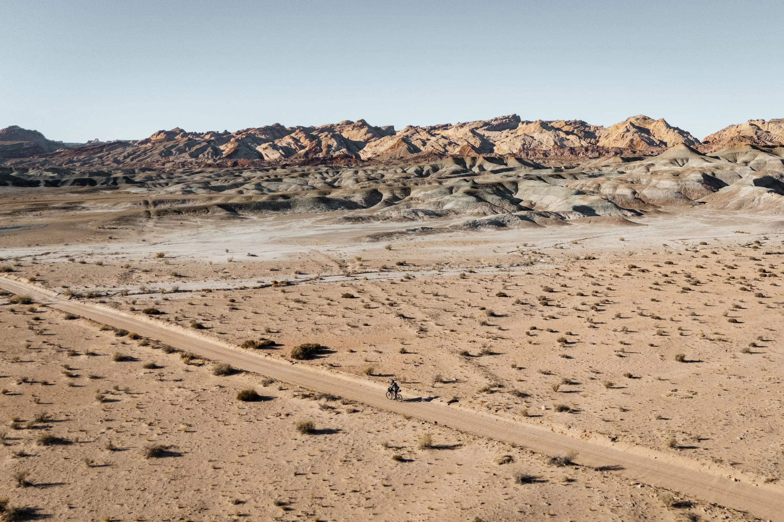
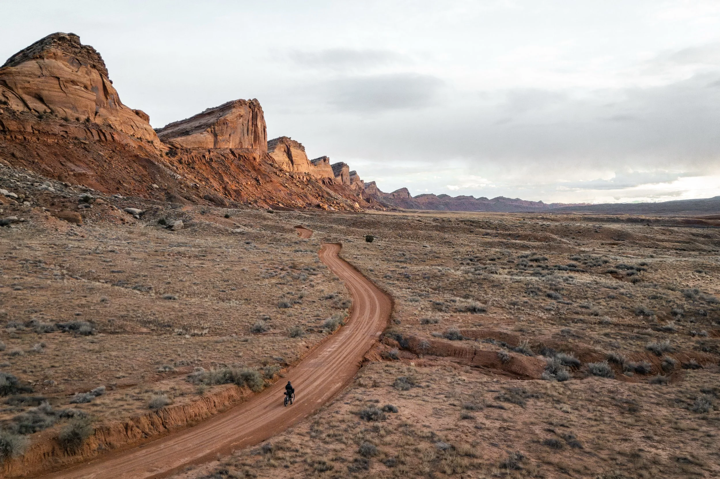
This route is not merely a ride across a state; it's a journey back in time through a prehistoric landscape where the geological past is laid bare in rock. Stretching over 1,100 kilometres, the Red Rock Route connects the iconic sandstone deserts of the east with the high-altitude forests of the western plateaus. It is designed to be a comprehensive tour of Utah’s most dramatic terrain, favouring rugged doubletrack and lonely dirt roads that sever the horizon for days on end.
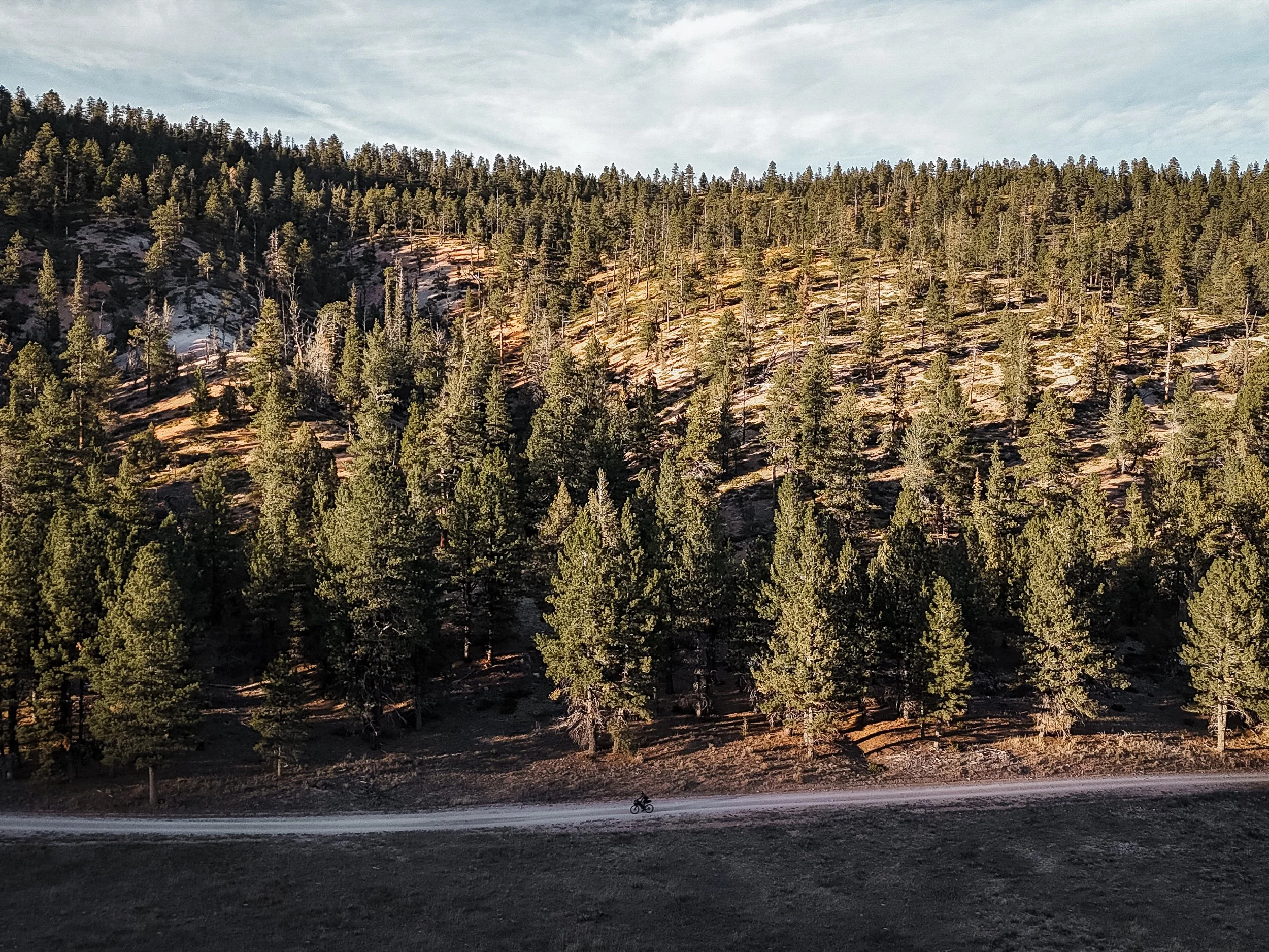
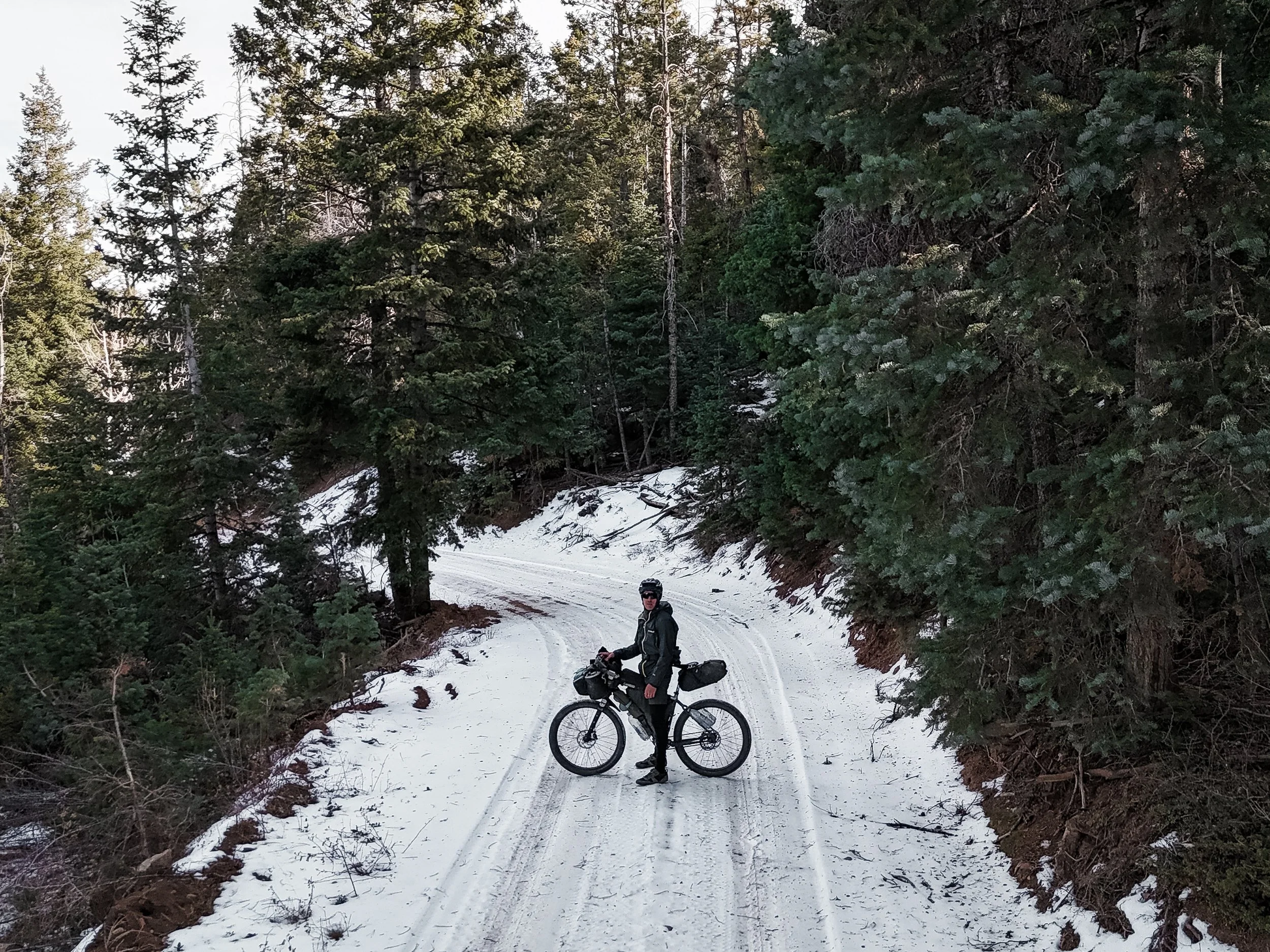
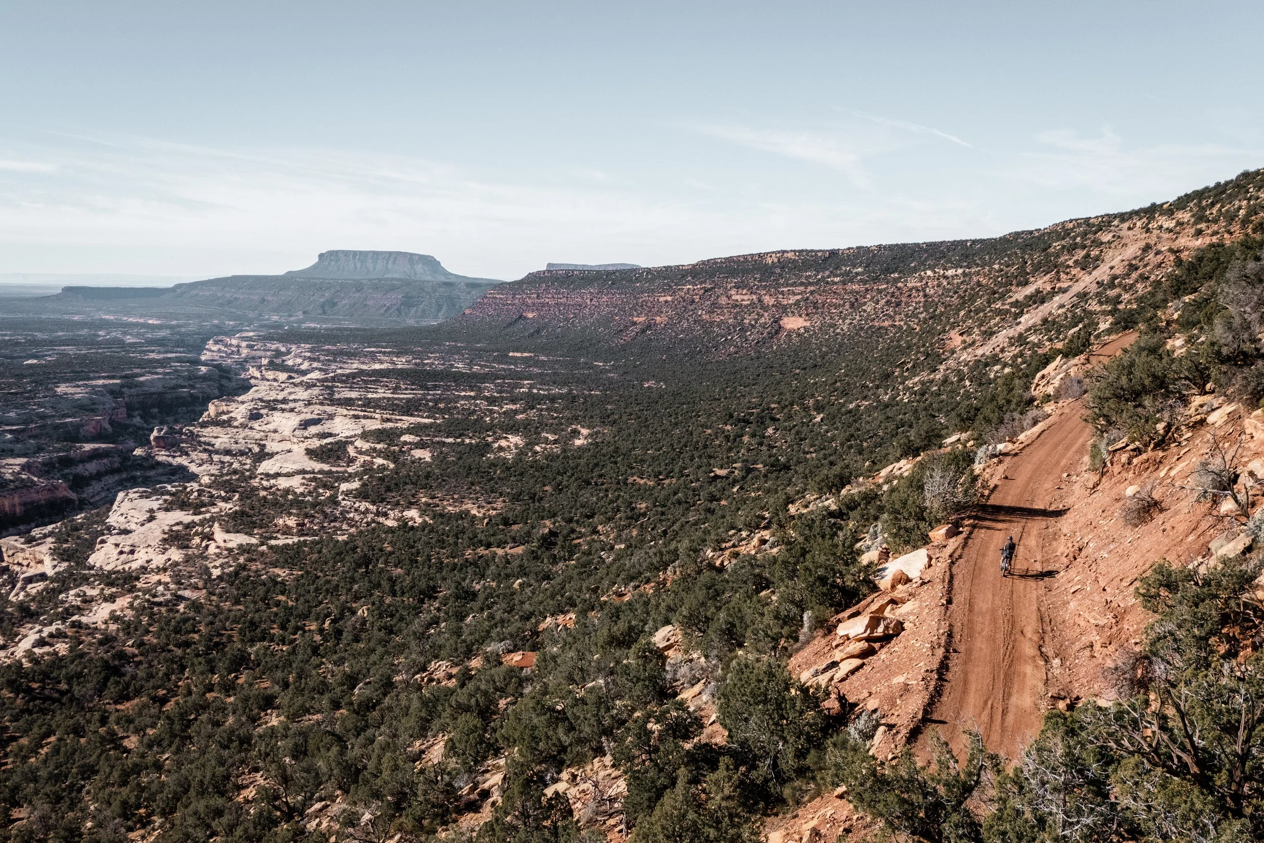
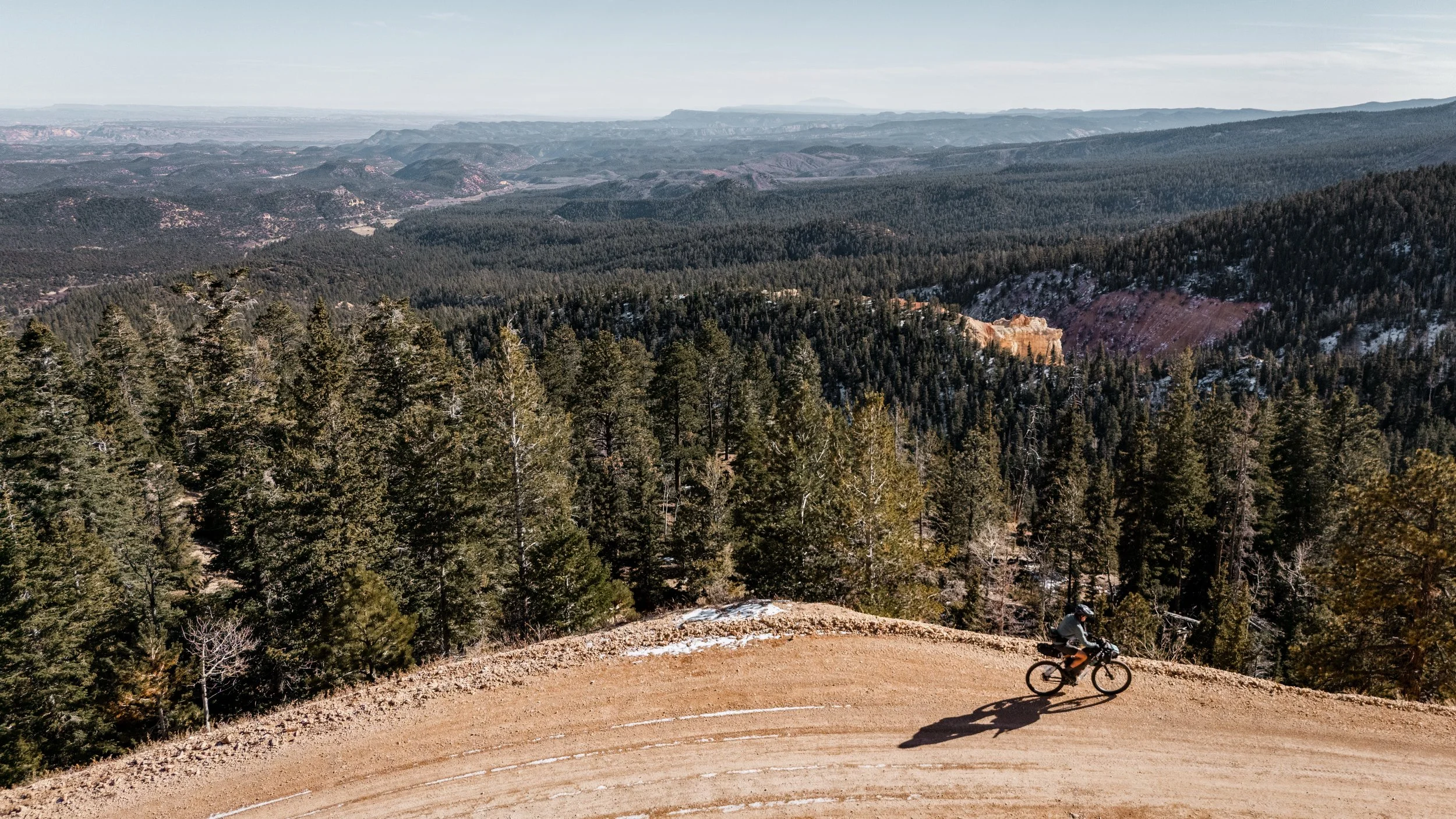
The route is characterised by its immense solitude and scale. Starting beneath the high peaks of the La Sal Mountains, it drops down into the labyrinthine canyons of the Colorado River, before climbing up into the immense high plateaus that define the western horizon. You will pedal through vast, silent expanses, where the ribbon of road cuts through layers of sedimentary history—millions of years of erosion on display. The transition from the arid, sun-baked desert near Moab to the alpine basins near Bryce—often dusted in snow during shoulder seasons—creates a striking dichotomy that defines the experience.
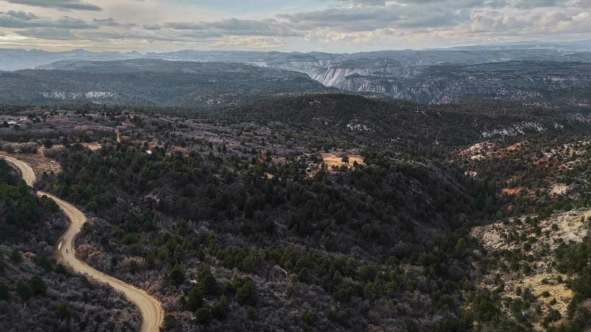
You will pedal through the vast, silent expanses of the Grand Staircase-Escalante National Monument, where the road ribbons through layers of sedimentary history exposed by millions of years of erosion. The transition from the arid, sun-baked basins of Canyonlands to the high alpine passes near Bryce Canyon—often dusted with snow in the shoulder seasons—creates a striking visual dichotomy that defines the ride.
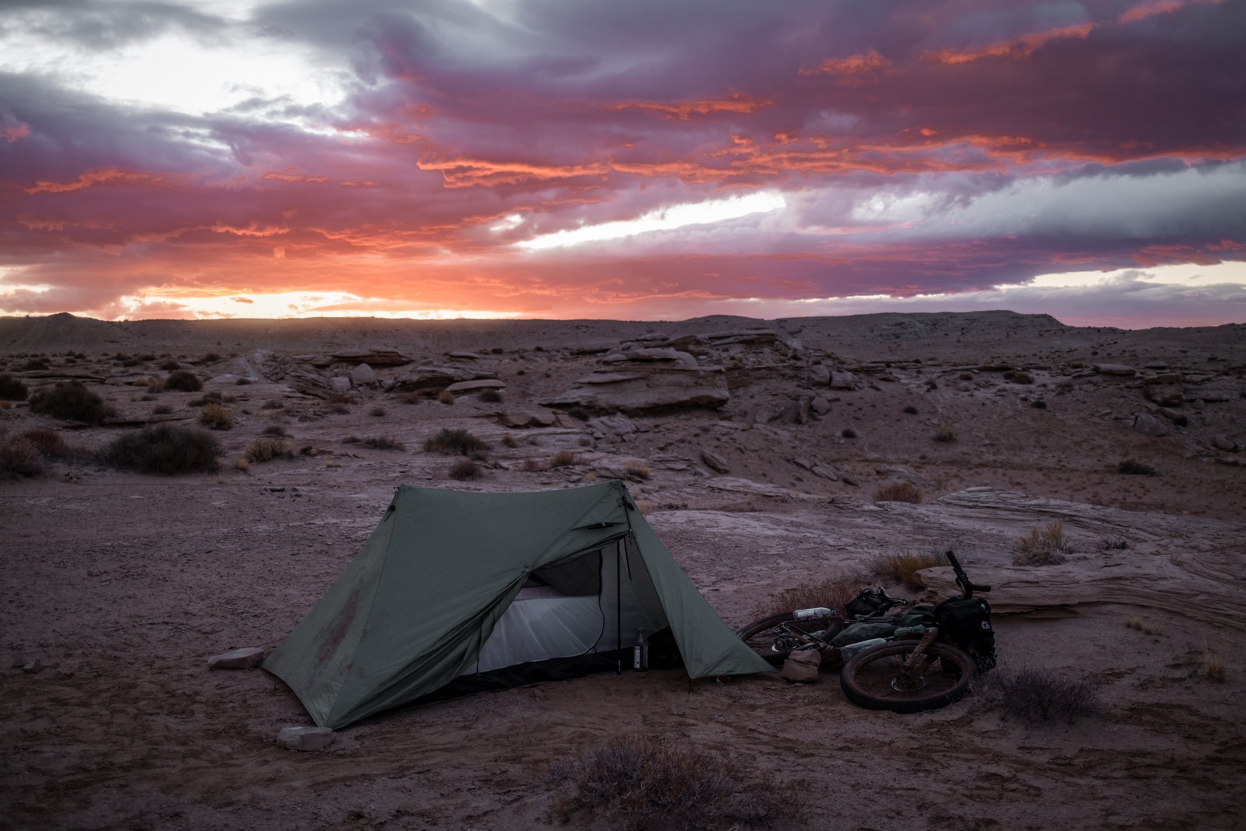
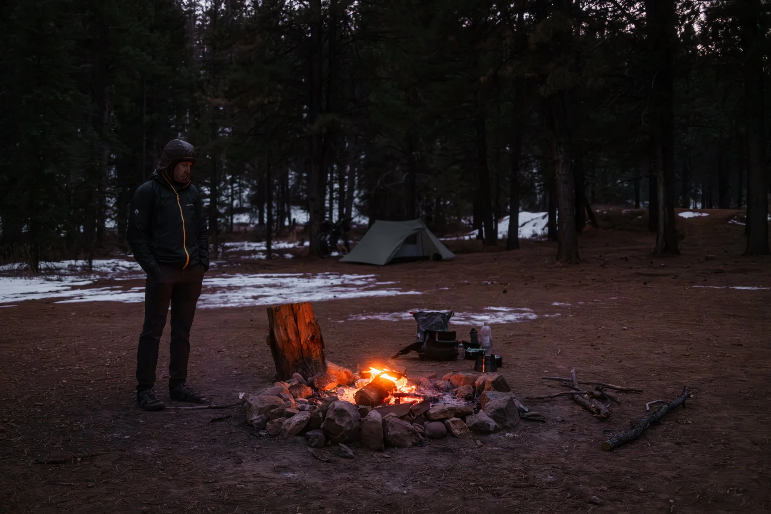
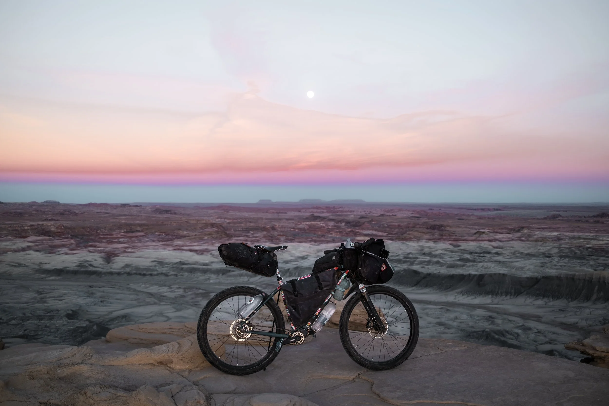
Unlike the technical singletrack of Moab’s famous slickrock, this route focuses on the "long haul" endurance of gravel and dirt touring. It brings riders face-to-face with the harsh realities of the desert: scarce water, extreme temperatures, and significant distances between resupplies. The rewards are equally immense. You will camp beneath some of the darkest skies in North America, pitching your tent on clifftops and waking as the morning sun ignites the vast, broken landscapes below.
This is a route for those who seek silence, rugged beauty, and the profound satisfaction of crossing a landscape that feels entirely indifferent to human presence.
The route was born from a desire to stitch together the most iconic landscapes of Southern Utah into a single, cohesive crossing. Drawing on segments from established routes and local knowledge of remote connector roads, the aim was to create a linear journey that captures the diversity of the state—from frozen alpine peaks to arid desert basins—in one continuous push. The route stands on the shoulders of the region's pioneers, owing a profound debt to the community knowledge embedded in the Peaks & Plateaus, Cedar Mesa, Bears Ears, Stone House Lands, and Cathedral Valley loops. Many thanks to the creators who paved the way.
Overall Difficulty Rating: 7/10
Physical (7/10): Whilst the route does feature a fair amount of climbing, it's not extreme, but the main challenge will come from the environmental conditions. Even if riding the route in the shoulder seasons, days can be incredibly hot, and nights can be very cold. These factors also require a more heavily loaded bike, as significant water carry is sometimes required. On the flatter sections, the wind can be a major problem. The physical challenge of this route should not be underestimated.
Technical (6/10): The route is primarily comprised of dirt roads, doubletrack, and gravel. Technical difficulty comes in the form of rough tracks, slickrock, occasional deep sand, and potentially snow/ice, depending on the season. After heavy rain, peanut butter mud can be a major issue, making progress practically impossible, which may require some rerouting.
Logistics (8/10): This is a true expedition route. Resupply points are few and far between, with one section requiring 5 days of food capacity and 2 days of water simultaneously. Water is the critical logistical hurdle; natural sources are rare, and caching or carrying large capacities (8-10 litres) will be necessary on multiple occasions. It's essential that you check the route carefully to ensure that you always have enough food and water to get to your next resupply point.
Distance: ~1,126 km (700 miles)
Elevation Gain: ~17,000 m (approx. 55,000 ft)
Recommended Time: 16-20 days
% Unpaved: 62%
% Singletrack: <1%
% Rideable: 99%
HIGHLIGHTS
Moab Departure: Beginning the journey in the spiritual home of off-road cycling, with endless options for side adventures before leaving civilisation behind. If you have time, it's highly recommended to bikepack the White Rim Trail and explore both Canyonlands National Park and Arches National Park, as all are spectacular.
Lockhart Basin: A rugged, isolating stretch of jeep track sandwiched between the Colorado River and sheer red cliffs.
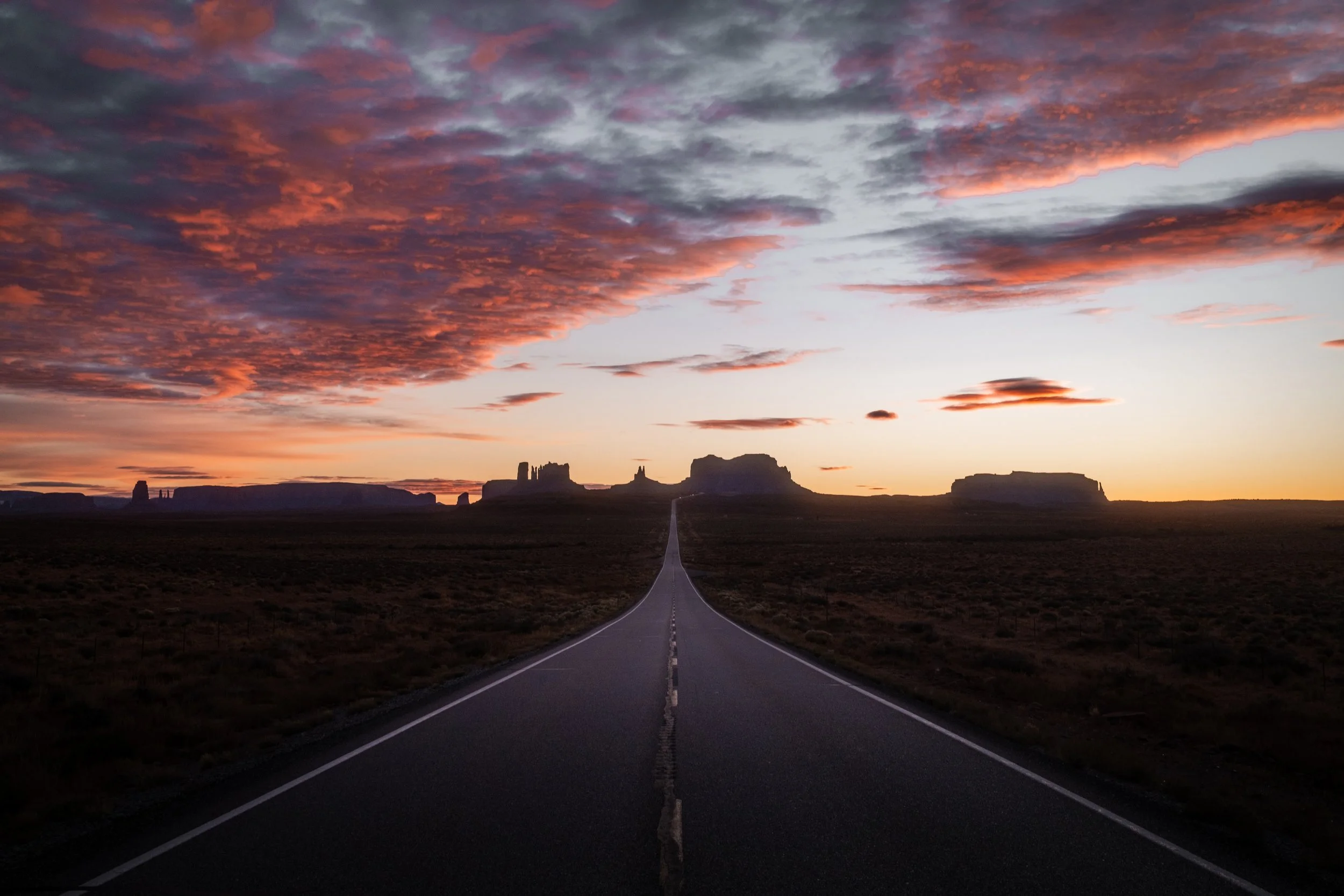
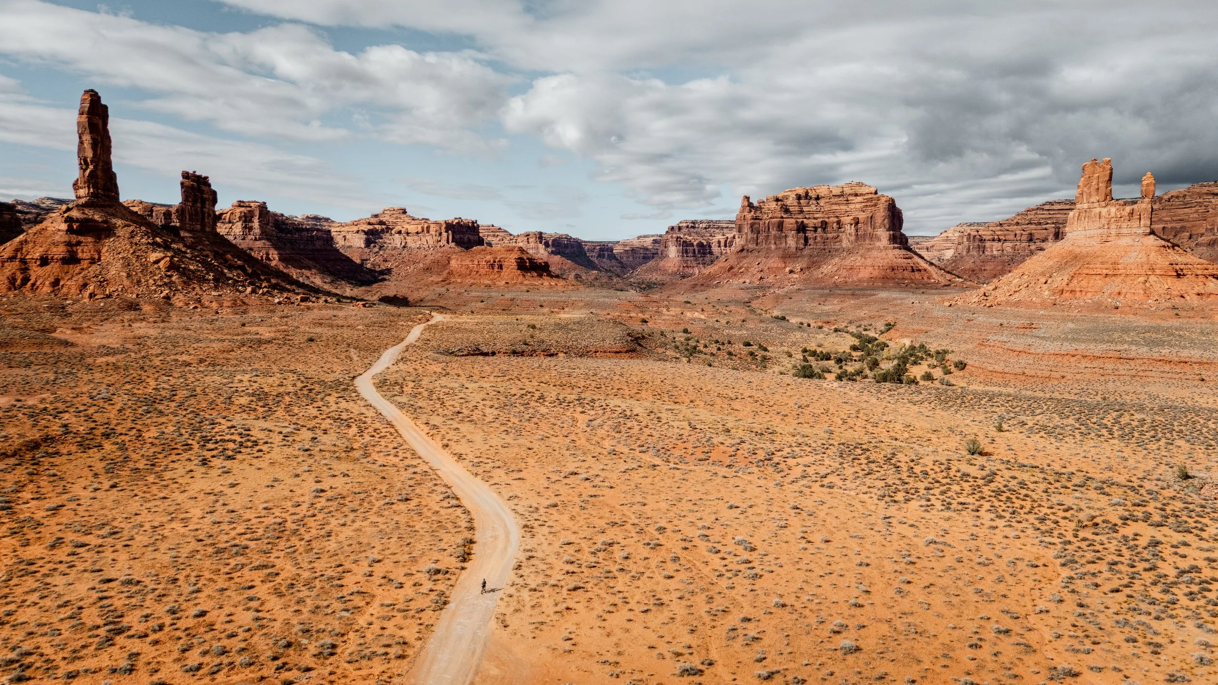
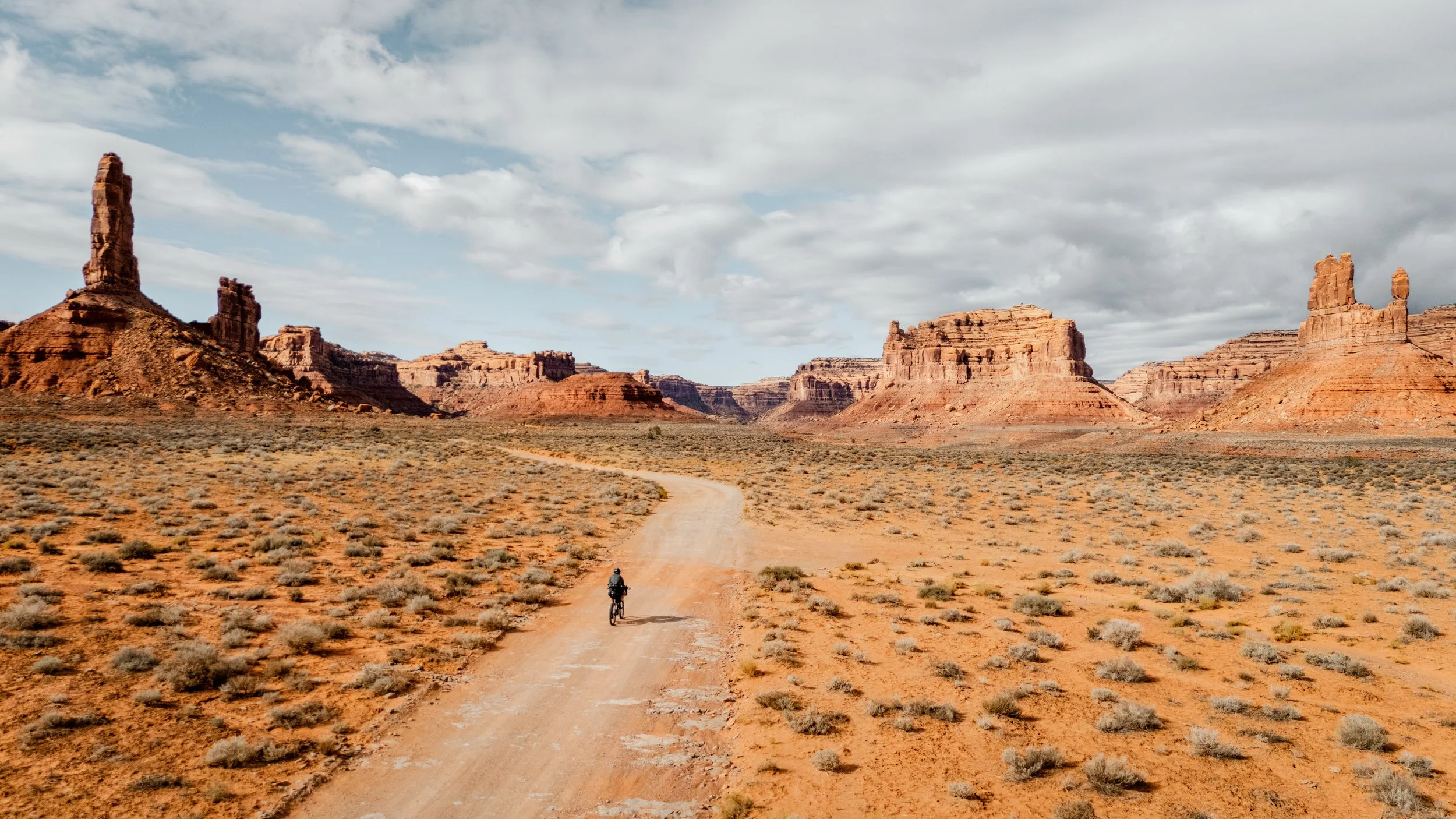
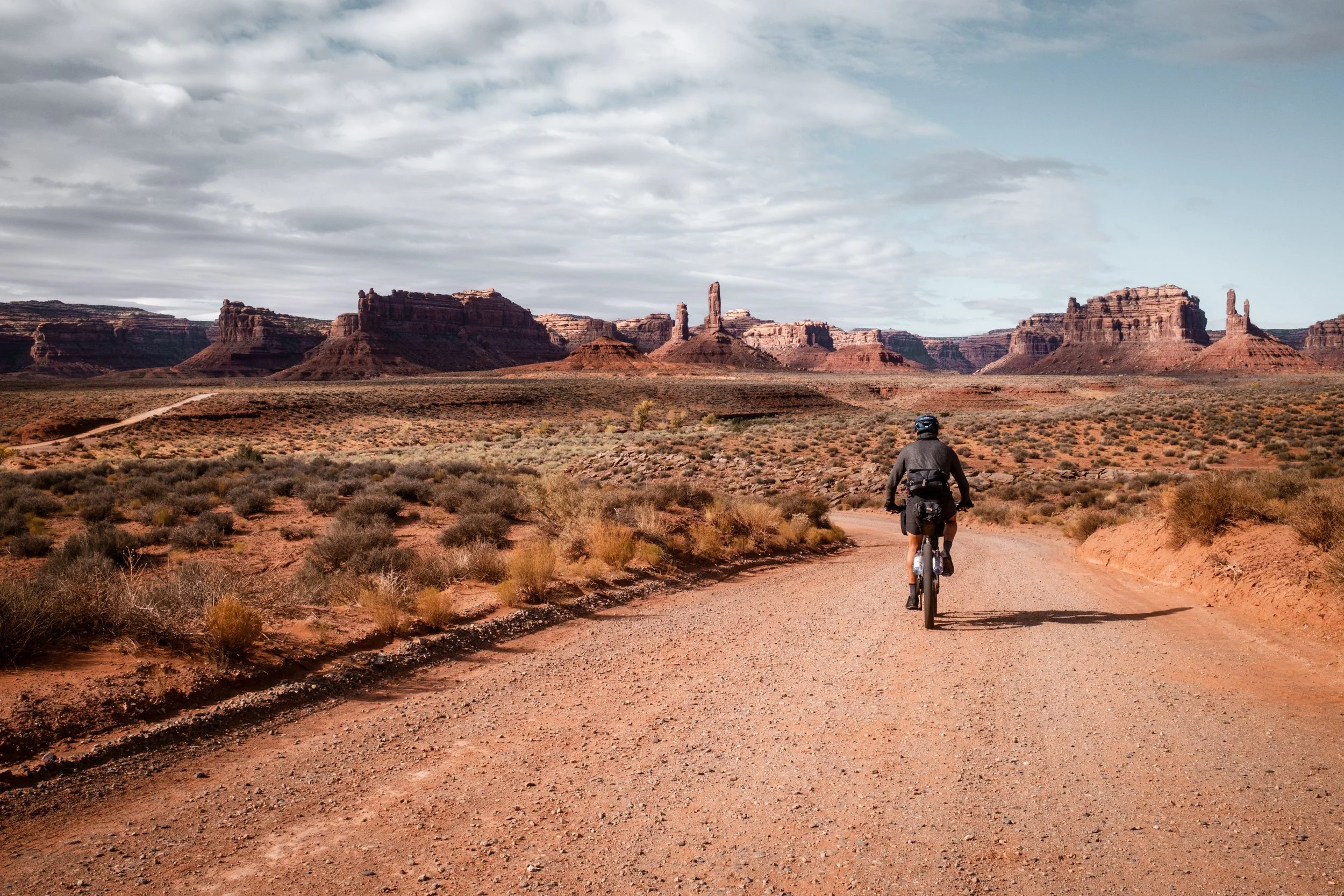
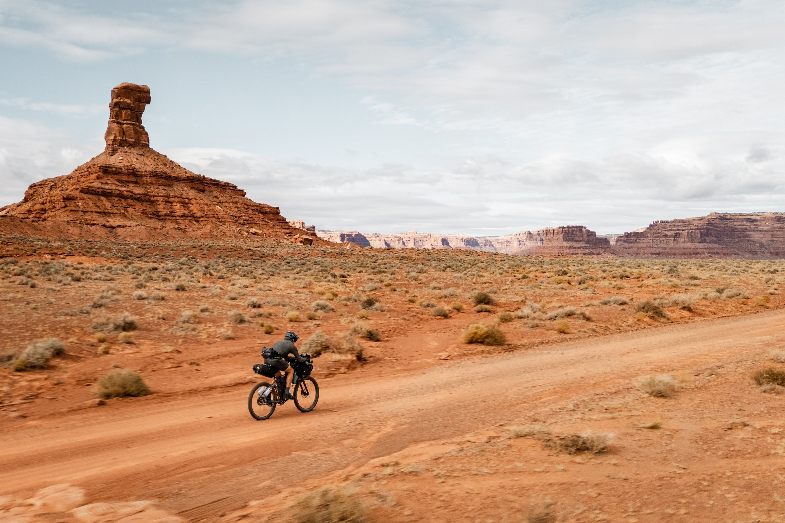
The Valley of the Gods: Smaller and much quieter than the nearby Monument Valley (which can also be visited with a short detour), this scenic backcountry loop winds through isolated sandstone buttes and towering pinnacles that rise abruptly from the desert floor.
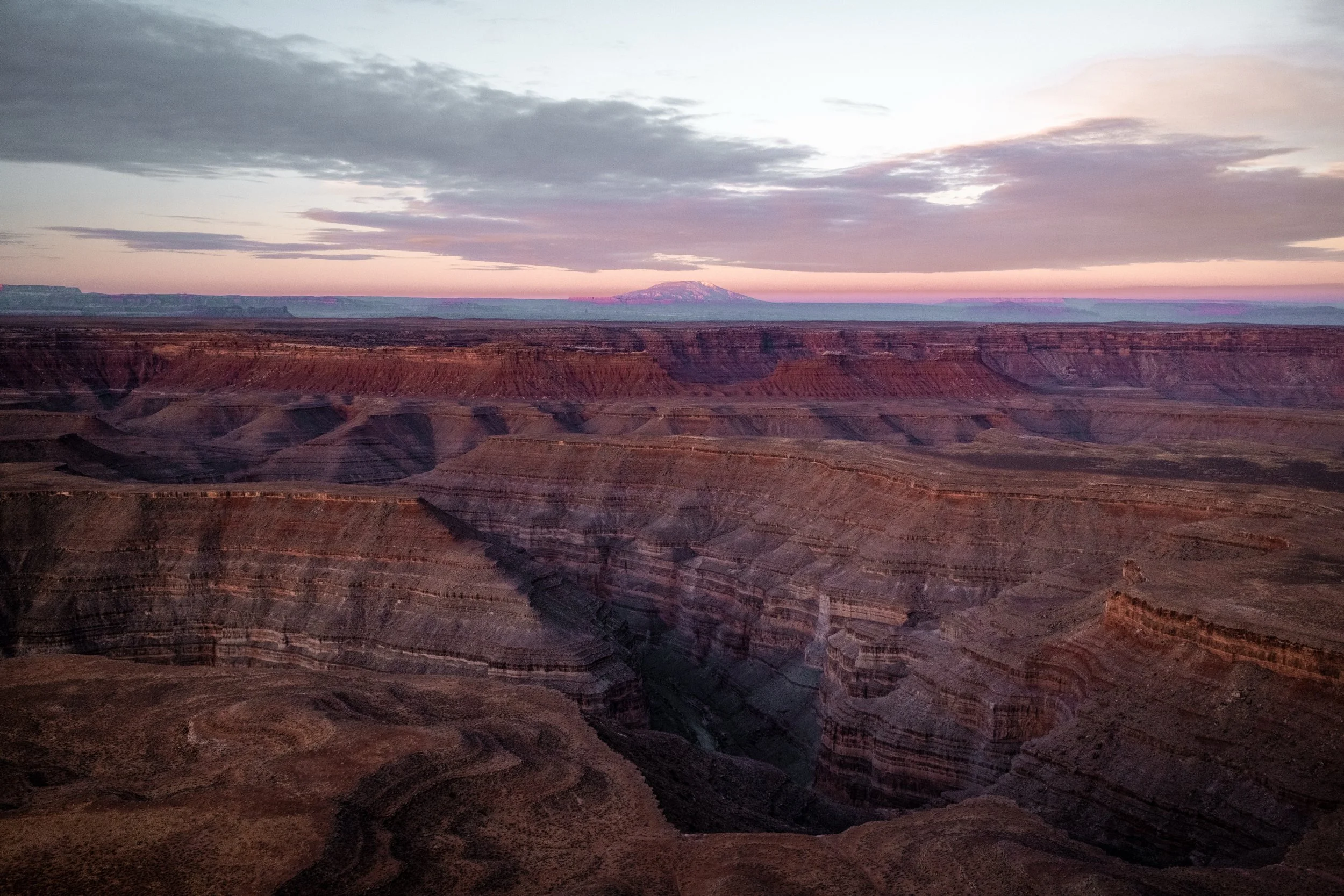
The Moki Dugway and Muley Point: A staggering, graded dirt switchback road carved into the sheer face of Cedar Mesa. The effort culminates at Muley Point, an unmatched wild camping location offering dizzying, panoramic views of the San Juan River goosenecks and towards Monument Valley far below.
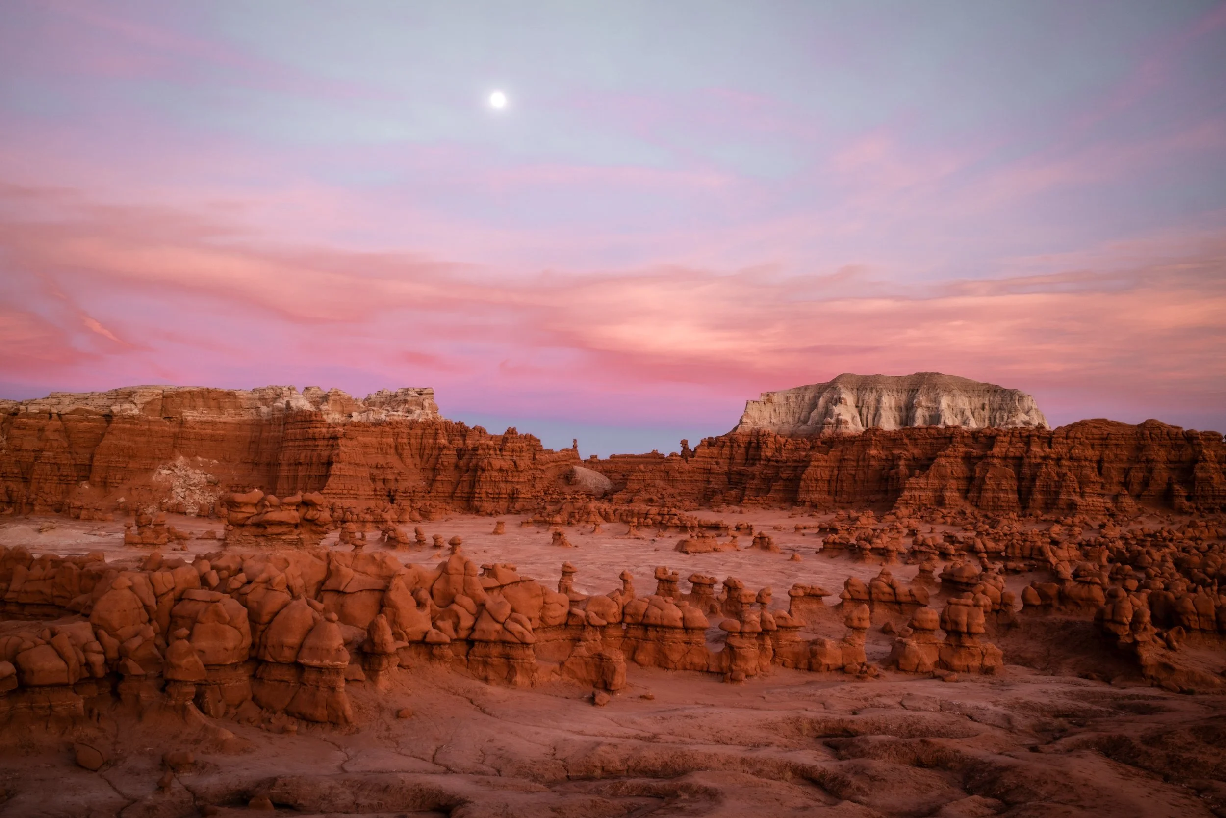
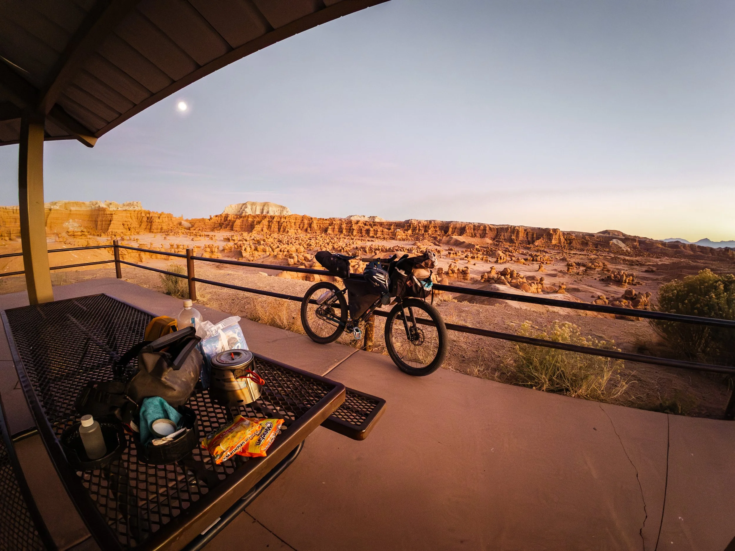
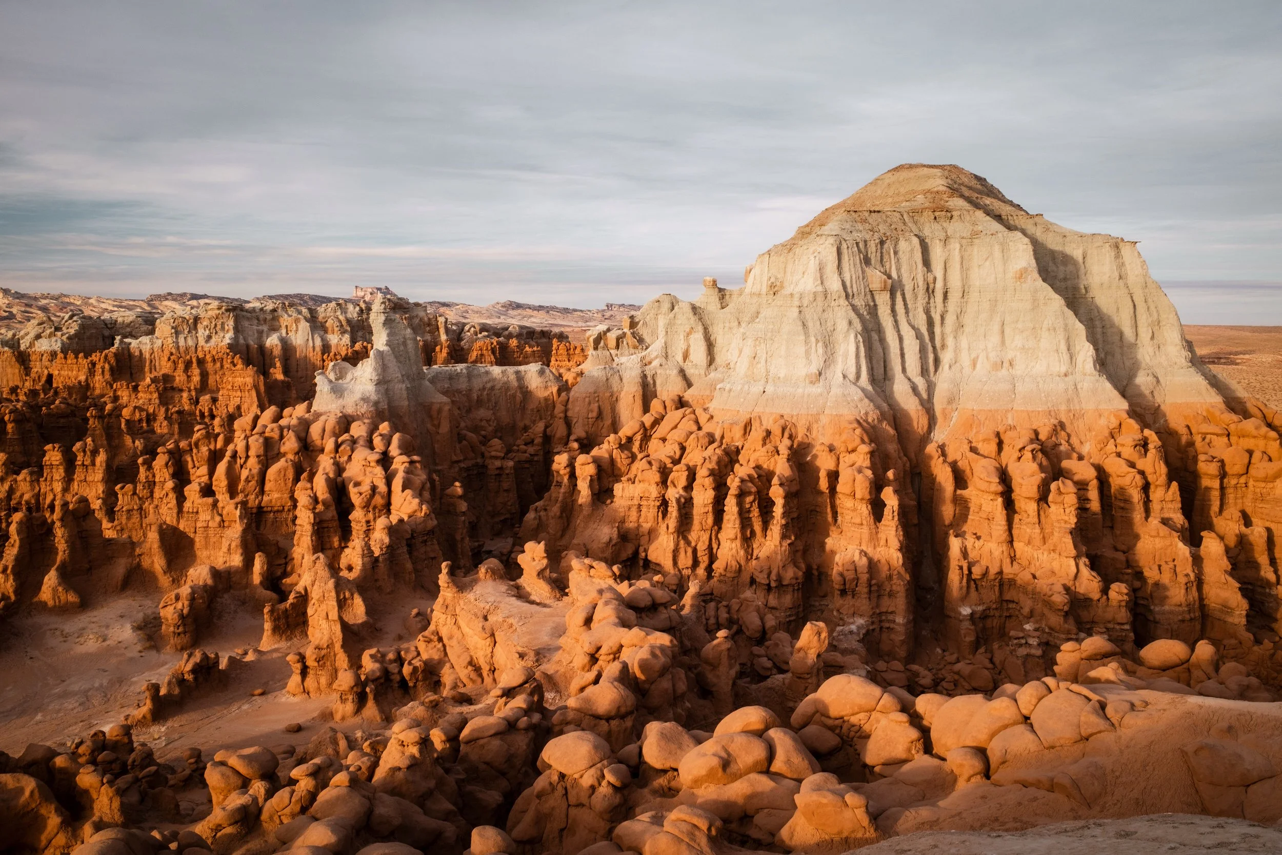
Goblin Valley State Park: A surreal landscape of thousands of mushroom-shaped "hoodoos," eroded into strange and whimsical forms that create a natural labyrinth begging to be explored on foot
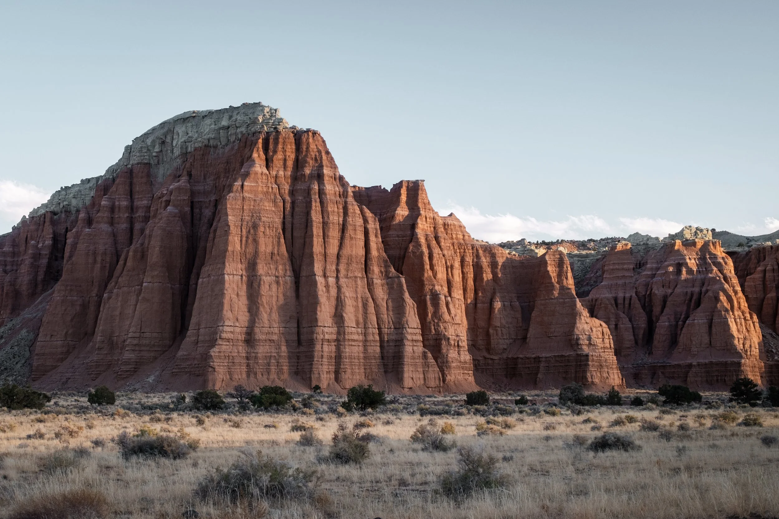
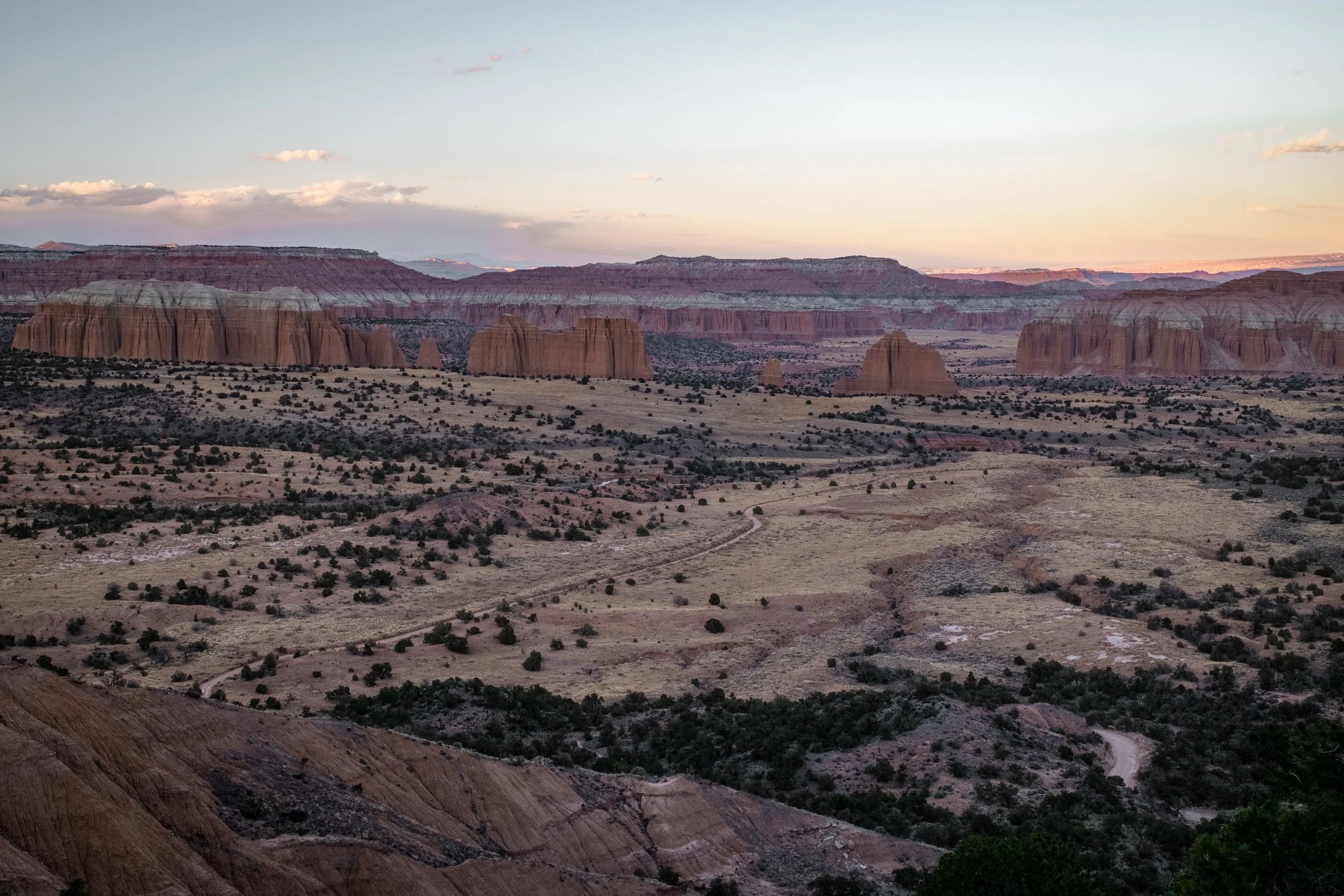
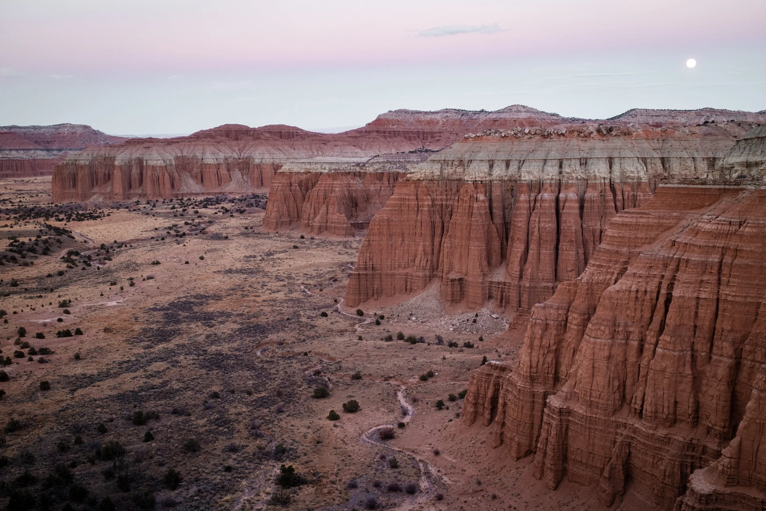
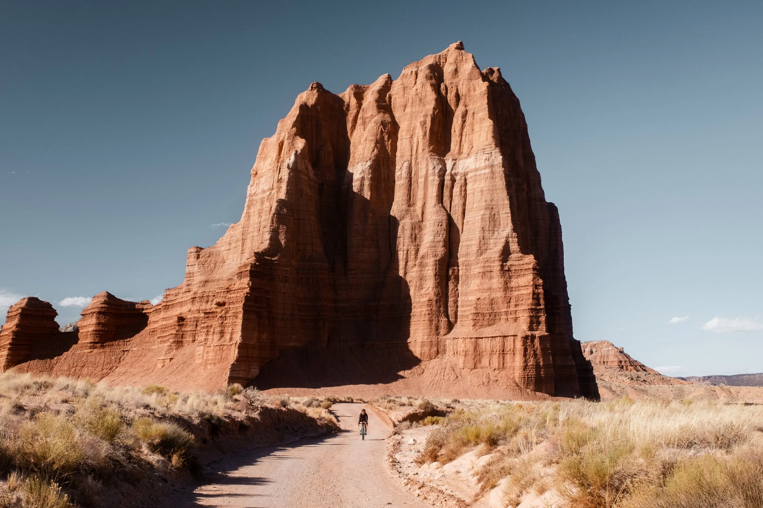
Cathedral Valley: Riding beneath the monolithic sandstone formations that give this remote valley in Capitol Reef its name. Key landmarks include the Temple of the Sun and Temple of the Moon, but the whole region is spectacular.
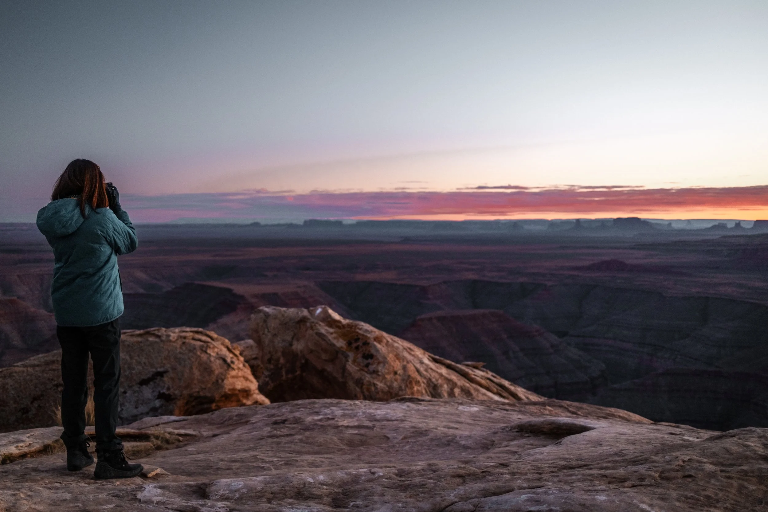
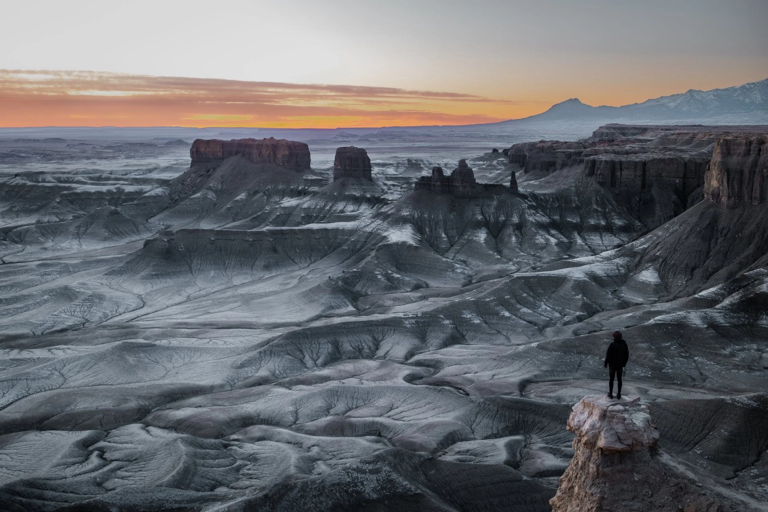
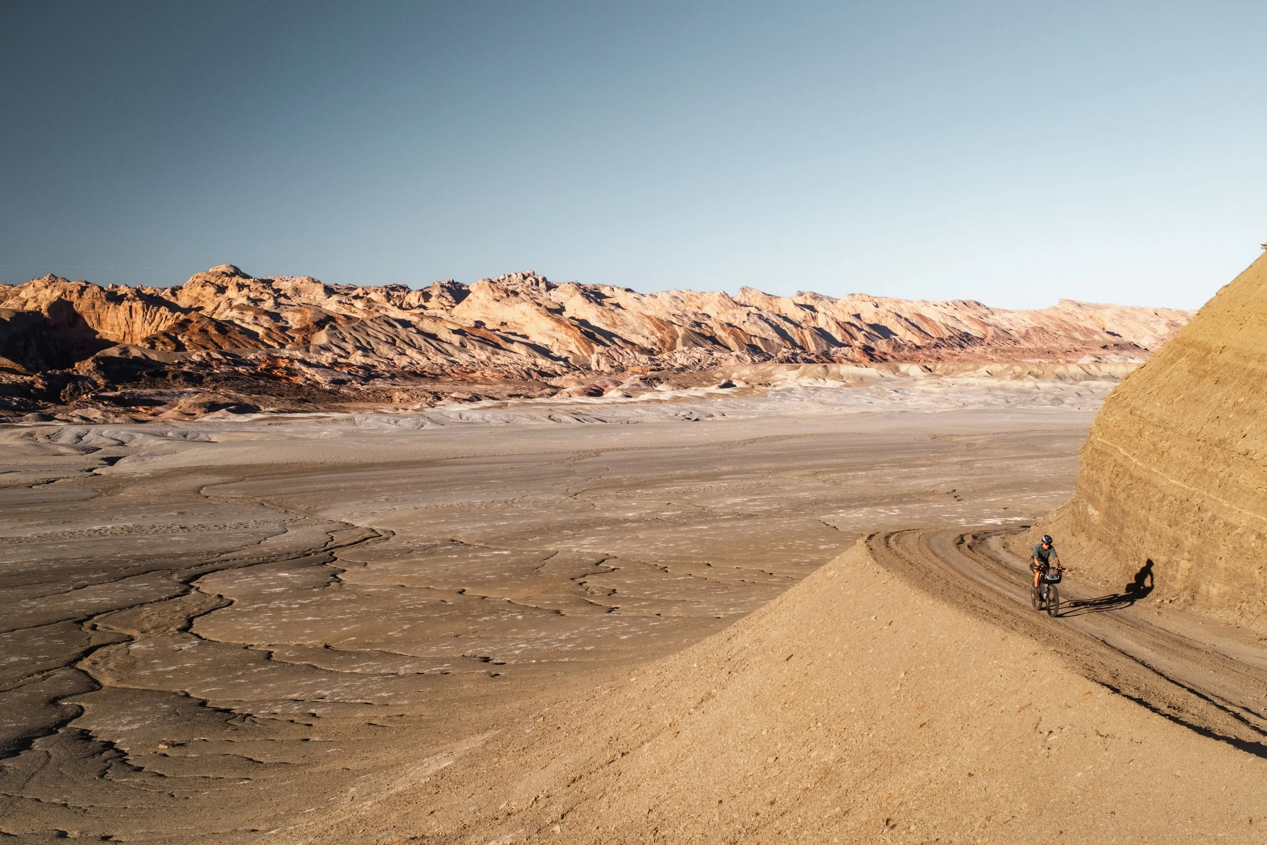
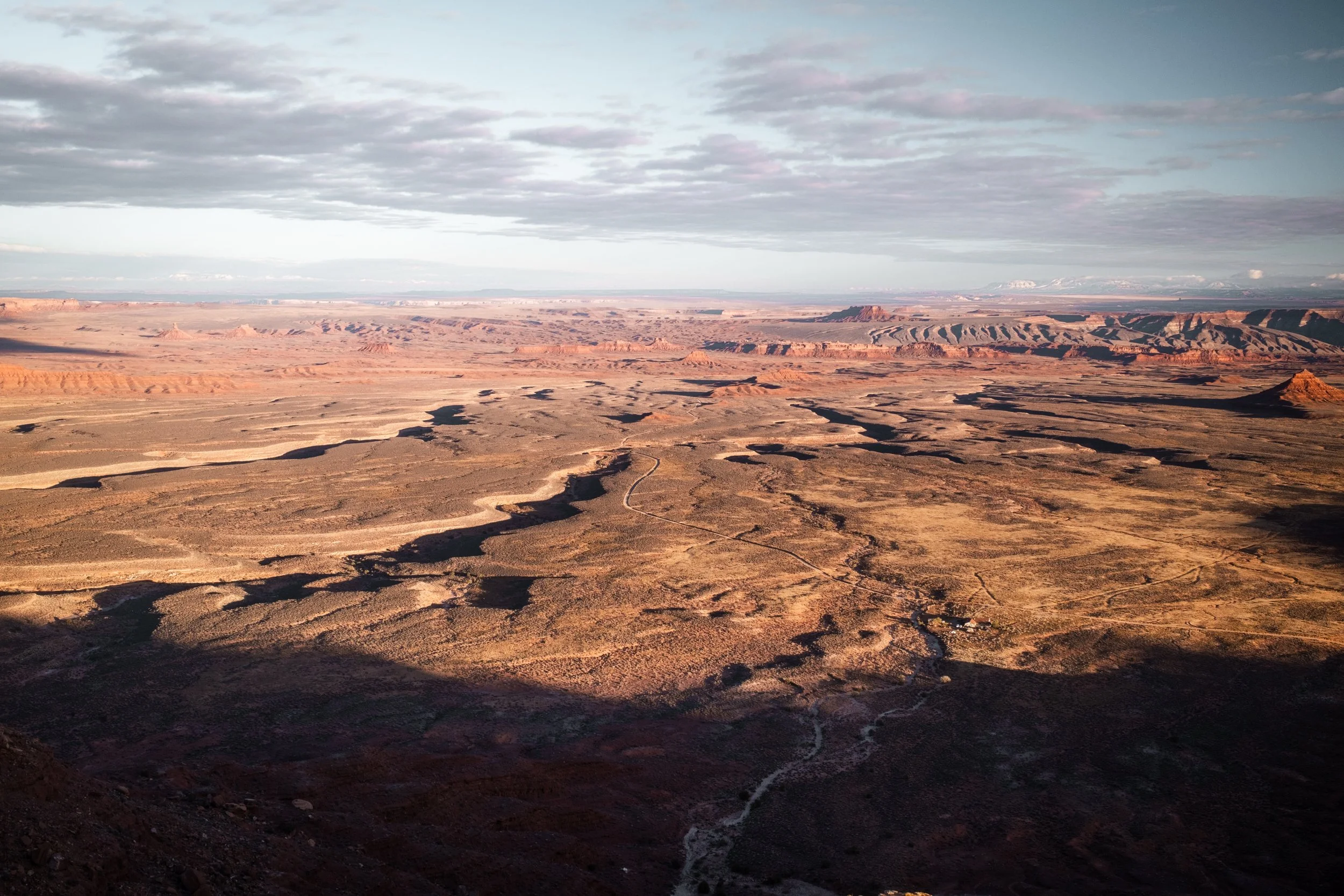
Moonscape Overlook: A photographer's dream, this clifftop lookout provides expansive views across the lunar landscapes of the Blue Valley and the jagged skyline of the Henry Mountains, and also makes for another premier wild camping spot for sunrise.
The Burr Trail Switchbacks: A legendary climb through the Waterpocket Fold in Capitol Reef National Park, winding up from the canyon floor.
Hell’s Backbone Bridge: A breathtaking traverse connecting Boulder and Escalante with precipitous drops on either side.
Grand Staircase-Escalante: The vast scale of this region dominates the final leg of the route. The roads here are long and open, offering deep solitude and plenty of remote places to camp.
Dark Sky Reserves: Camping in some of the few remaining spots in the lower 48 with zero light pollution.
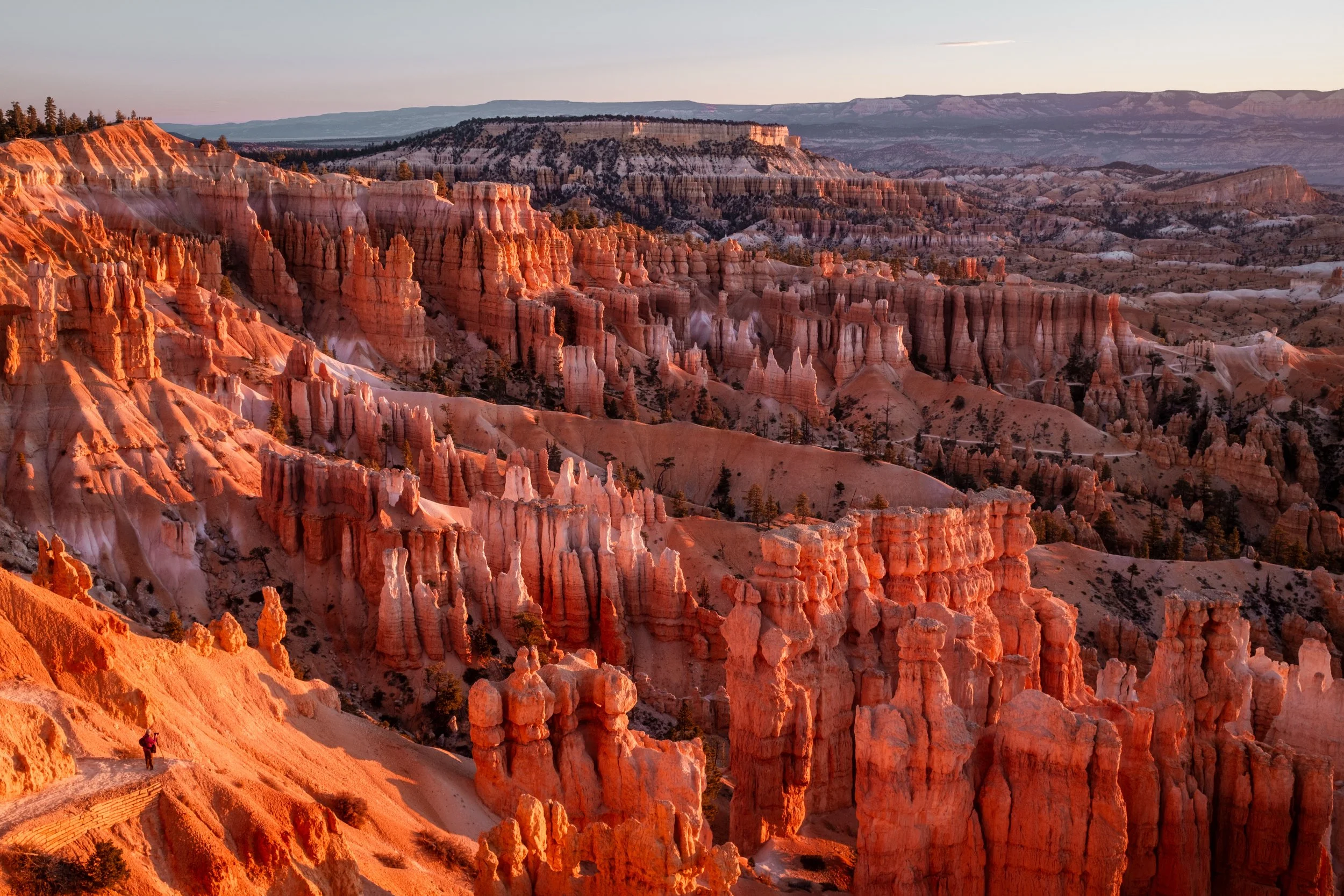
Bryce Canyon National Park: Famous for its crimson-colored hoodoos, which form a vast, natural amphitheatre carved into the eastern edge of the Paunsaugunt Plateau.
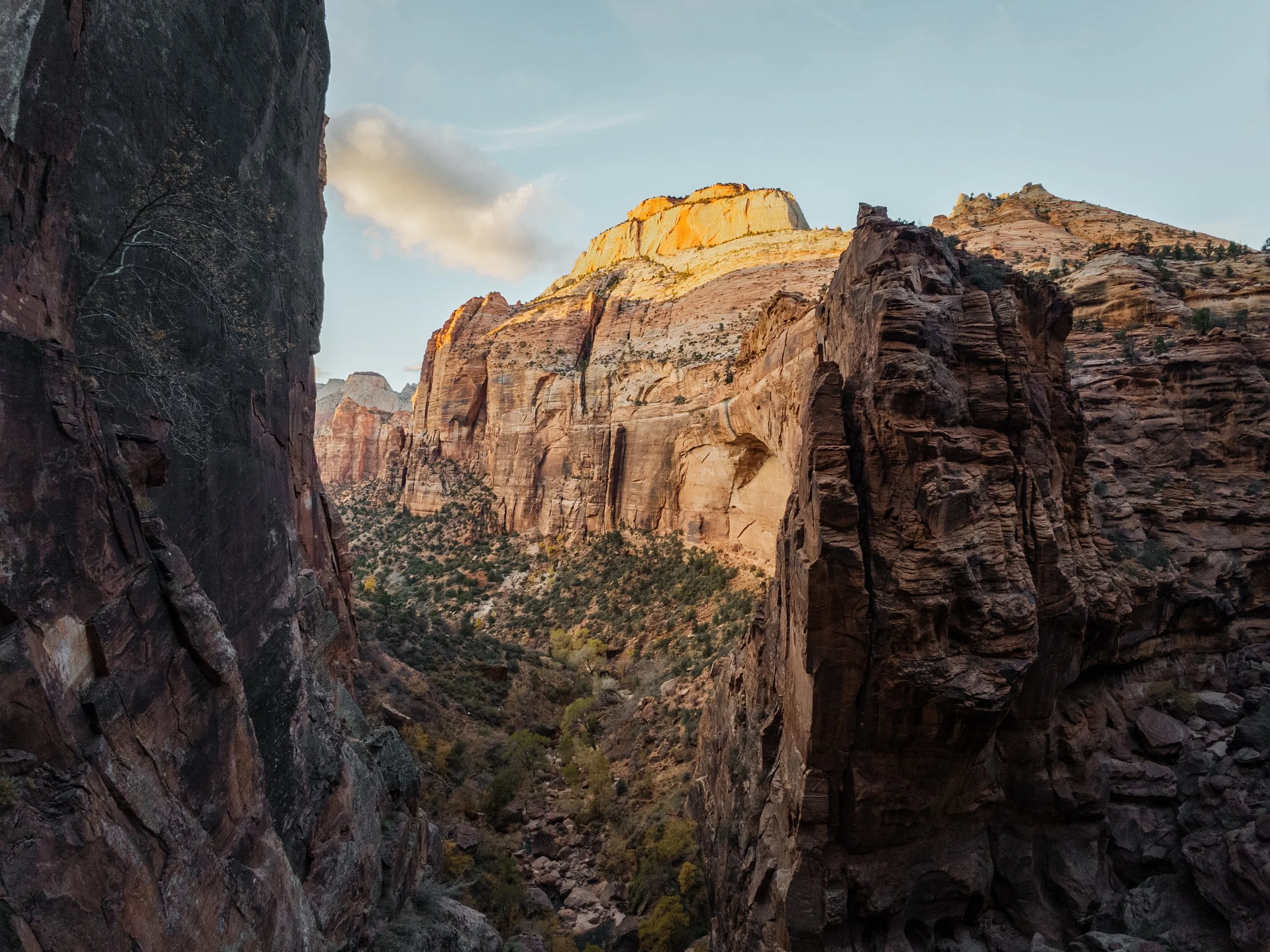
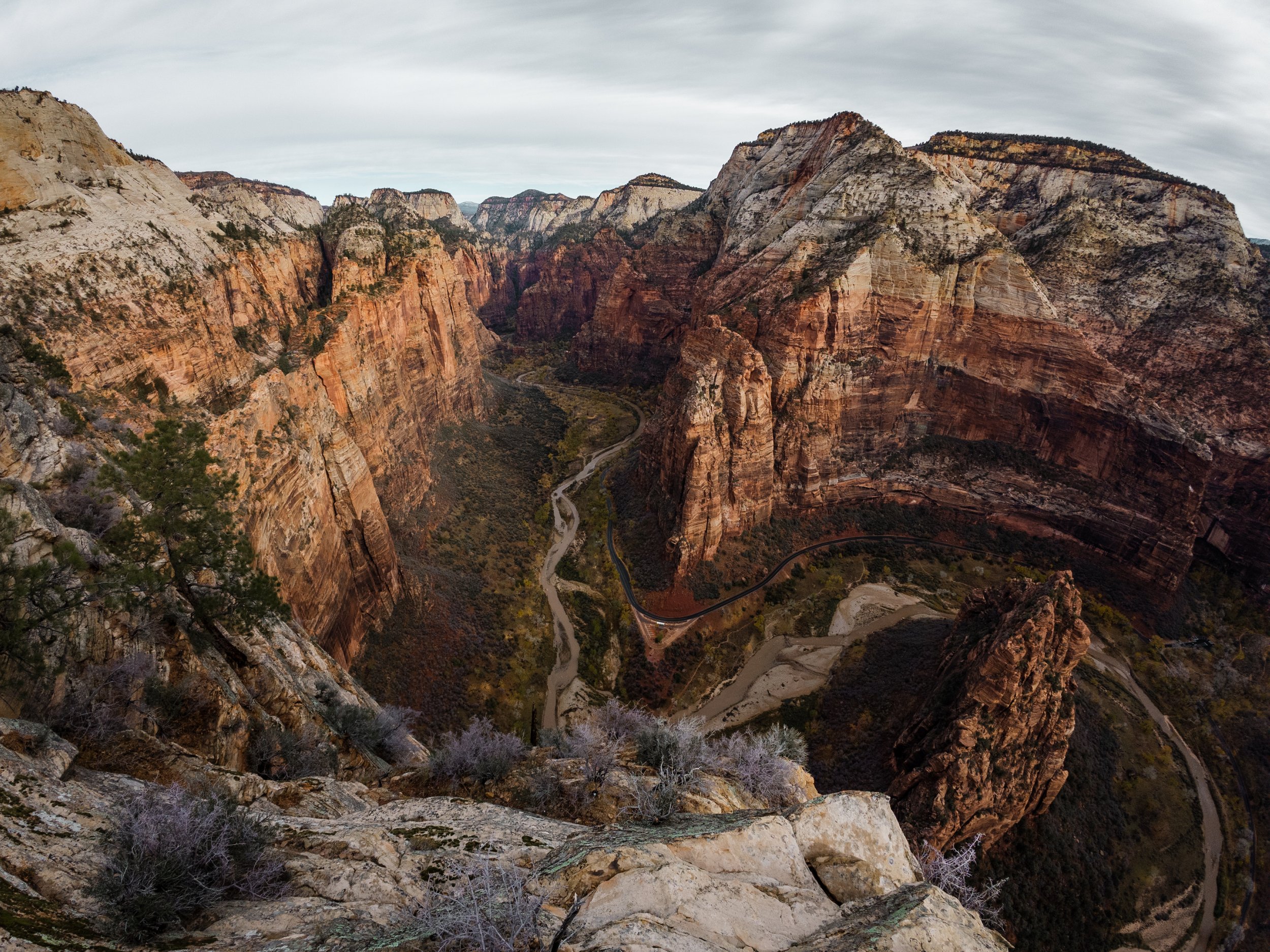
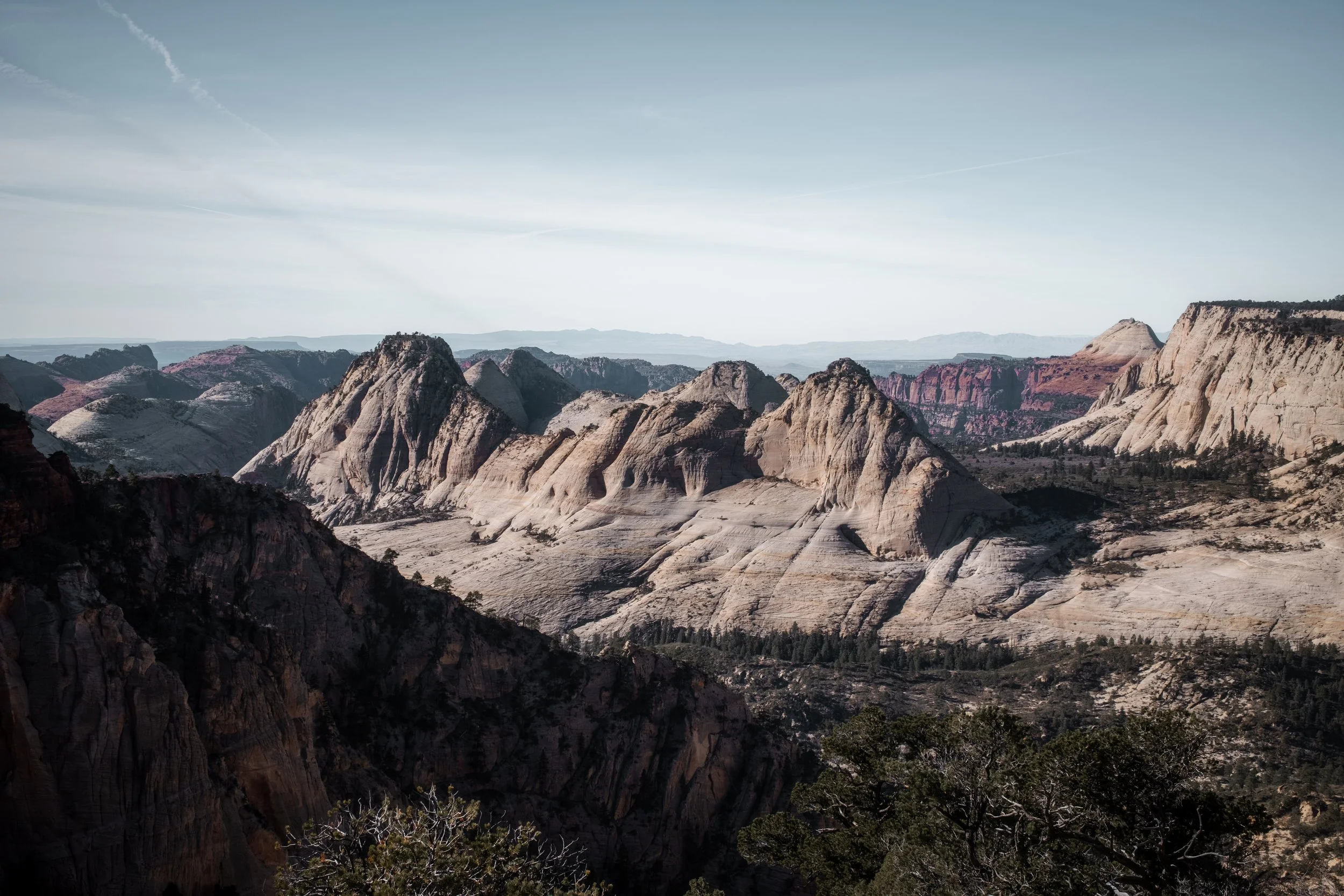
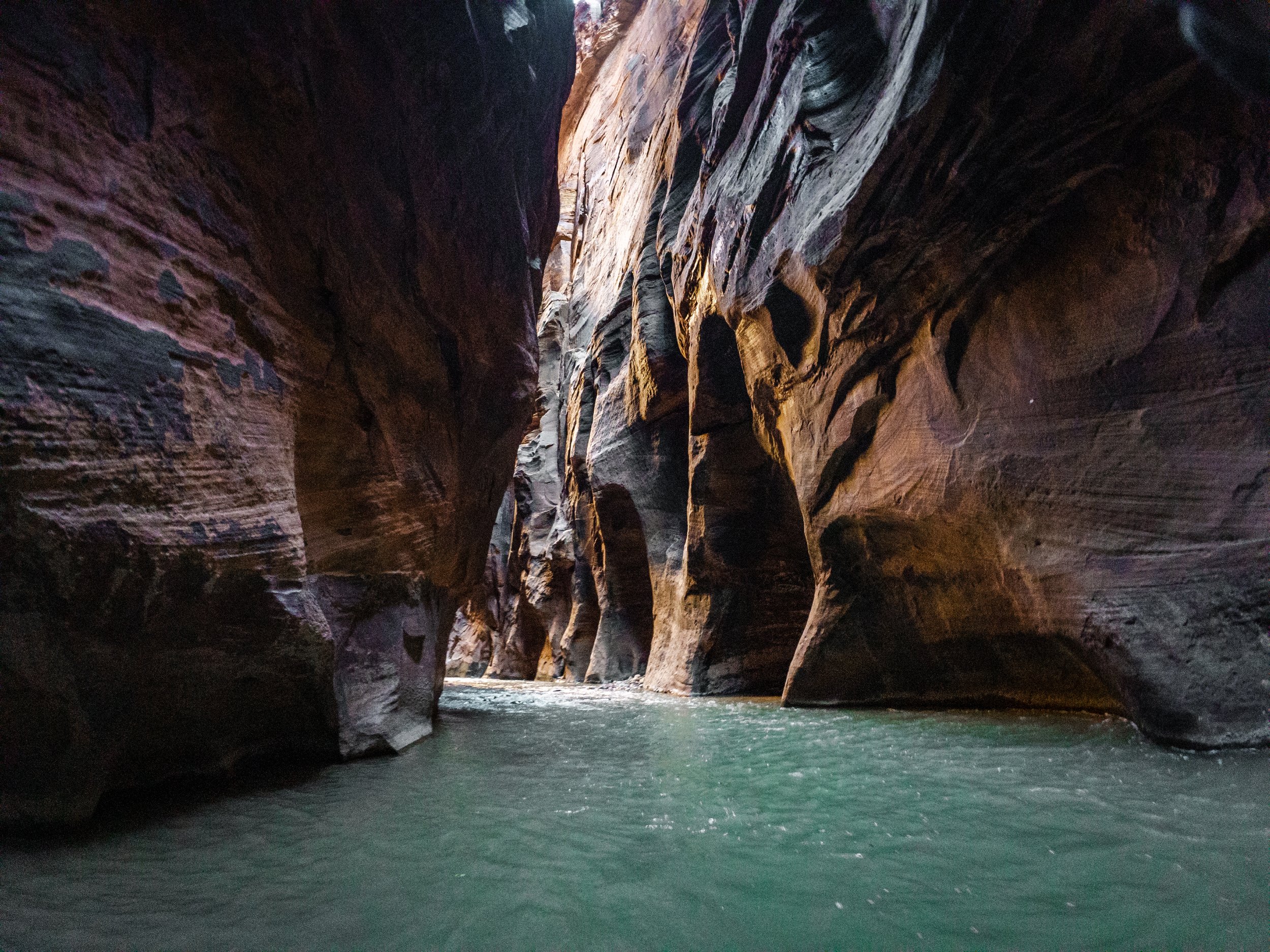
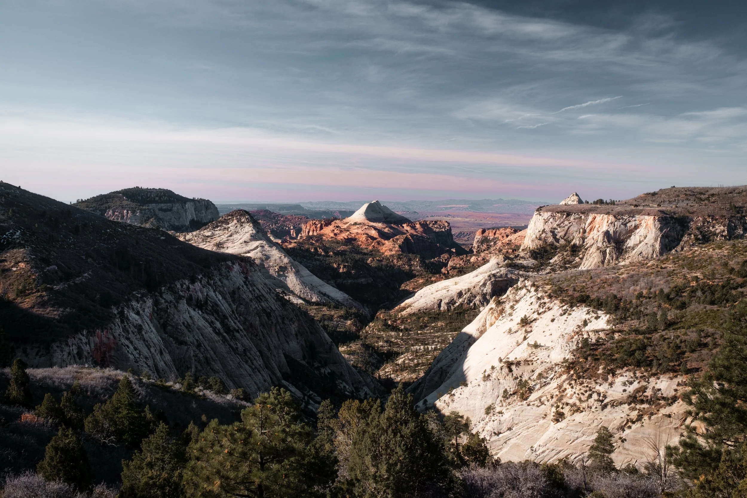
Zion National Park: The dramatic terminus of the journey, where the route descends into a canyon defined by massive Navajo Sandstone cliffs of cream, pink, and red.
MUST KNOW
Seasonality: Late Fall (Oct-Nov) or Early Spring (April-May) are best. Summer is dangerously hot (100°F+), whilst winter can bring deep snow and temperatures far below freezing.
Water is Life: Water sources are sparse, and you will sometimes need to carry water for multiple days, which, in the heat of the desert, can be a lot. You must carry a filter and capacity for at least 8+ litres.
Mud Danger: Utah dirt turns to "peanut butter" clay when wet. Do not attempt remote clay roads during or immediately after rain; you will get stuck.
Bike Choice: A mountain bike is unquestionably the best choice for this route, and it's suggested to fit the widest tyres that you can. I was able to ride just about all of it on 27.5 x 2.8" tyres, but thinner tyres may have you pushing through some sandy sections. A suspension fork would be nice, but isn't necessary. The route would be possible on a wide-tyre gravel bike, but this wouldn't be ideal - expect some extra pushing in the looser sections.
Remoteness: There is zero cell service for days. A satellite tracker (Garmin inReach/Spot) is highly recommended for safety.
CAMPING & LODGING
Wild Camping: Public land (BLM and National Forest) dominates the route, making wild camping easy, free, and legal almost everywhere. There are multiple options for 'cliff-top' wild camps overlooking spectacular vistas - these form a major highlight of the route, and are marked on the map.
Campgrounds: Established campgrounds are available in National Parks and State Parks, but often require reservations in peak season.
Lodging: Hotels and motels are available only in the sparse hubs, such as Moab, Hanksville, Boulder, Escalante, and Zion. There are a few points where detouring off the route provides access to additional services.
FOOD/H2O
Resupply Hubs: Major resupply is limited, and you will need to carry food for 3-4 days depending on your pace. Planning ahead is essential.
Water: Natural water is scarce and should always be treated. Mostly, you will be filling up in settlements, requiring you to carry 1-2 days' worth of water on a regular basis. Always ensure you know when your next source will be, and that you have enough water to get you there.
Food: Carry extra calories. The terrain is slower than expected, and running out of food in the backcountry is a real risk.
TRAIL NOTES
The following is a suggested itinerary of 16 days, with approximate distances and elevation gain statistics included, as well as notes about resupply and camping.
Day 1: Moab to Lockhart Basin. Stock up on water for 2 days and food for 3 days before leaving Moab and heading out into Lockhart Basin. Depending on conditions, you will likely have some hike-a-bike to get through parts of Lockhart Basin Road. 65 kilometres, 1200 metres (40 miles, 4,000 feet)
Day 2: Lockhart Basin to the Abajo Mountains. After making it through Lockhart Basin, you can detour to the Needles Visitor Centre in Canyonlands for water resupply if needed. Continue over the Abajo Mountains, natural water sources are available on the far side of the pass, and a detour to Monticello is an option if food and lodgings are desired. 70 kilometres, 1500 metres (43 miles, 4,900 feet)
Day 3: The Abajo Mountains to Comb Wash. A relatively straightforward day with a lot of elevation loss. Resupply is available in Blanding - unless you plan to detour to Mexican Hat the following day, you'll need to stock up with 4 days of food and around 2 days of water. 95 kilometres, 1400 metres (59 miles, 4,600 feet)
Day 4: Comb Wash to Muley Point. Spectacular riding through the Valley of the Gods. You will need to have stocked up on water and food - can be done either the day before in Blanding, by a detour to Mexican Hat, or at the Valley of the Gods Bed and Breakfast (the latter only with prior arrangement, see the map waypoint for details). A detour through Mexican Hat to Forrest Gump Point and Monument Valley is an option. Clifftop wild camping at Muley Point is highly recommended. 65 kilometres, 1200 metres (40 miles, 3,900 feet)
Day 5: Muley Point to the Bears Ears National Monument. You'll need to refill your water, either at the Kane Gulch Ranger Station (if it's open, depending on time of year) or via a short detour to the visitor's centre at the Natural Bridges National Monument. Wild camping is easy in the Bears Ears, but be aware that black bears are present, so be bear aware, and avoid having food in your tent. 75 kilometres, 1200 metres (47 miles, 3,900 feet)
Day 6: Bears Ears to the Colorado River. Through the mountains and back down to the tarmac across the Colorado. No water or services along this section. This section should be avoided after rain, as it's exceptionally susceptible to peanut butter mud when wet. If in doubt, detour via the paved Route 95. 80 kilometres, 800 metres (50 miles, 2,600 feet)
Day 7: The Colorado River to Hanksville. Straightforward and scenic paved ride back up to civilisation at Hanksville, where resupply and lodgings are available. 70 kilometres, 900 metres (43 miles, 3,000 feet)
Day 8: Hanksville to Moonscape Overlook. Stock up on food for five days, as there will be no resupply until you reach Boulder, likely on day 12. A really beautiful day passing by Goblin Valley, where it's highly recommended to stop and explore. Water is available at the visitor centre; you'll need to fill up with enough for 2 days. Clifftop wild camping at Moonscape Overlook is highly recommended. 75 kilometres, 800 metres (47 miles, 2,600 feet)
Day 9: Moonscape Overlook to Cathedral Valley Campground. A gorgeous ride through Cathedral Valley, passing the Temple of the Sun and Moon. No services or water. 75 kilometres, 1100 metres (47 miles, 3,600 feet)
Day 10: Cathedral Valley Campground to Cedar Mesa Campground. Beautiful ride out through the Bentonite Hills. Water is available at the Fremont river crossing, but it will need filtering. 80 kilometres, 800 metres (50 miles, 2,600 feet)
Day 11: Cedar Mesa Campground to Deer Creek Campground. Up through the Burr Trail switchbacks and through Capital Reef National Park. No water or services. 65 kilometres, 1500 metres (40 miles, 4,900 feet)
Day 12: Deer Creek Campground to Escalante. Back up into civilization at Boulder, before taking the spectacular road over Hell's Backbone Ridge to Escalante, where resupply and lodgings are available. 60 kilometres, 1000 metres (37 miles, 3,300 feet)
Day 13: Escalante to Bryce Canyon National Park. Beautiful ride up over Old Escalante Road. Services are available just outside Bryce, and there's plenty of space for dispersed camping. It's well worth taking an extra day here to explore the national park on foot before continuing. 80 kilometres, 1400 metres (50 miles, 4,600 feet)
Day 14: Bryce to Lava Flat. A couple of big climbs to leave behind Bryce Canyon. There's a nice area for camping at the Lava Flat Designated Dispersed Camping area, just outside the small village of Duck Creek, where services are available. Resupply is also available at Sinclair during the day, although shops may not always be open. 70 kilometres, 1300 metres (43 miles, 4,300 feet)
Lava Flat to Zion National Park. The final day, with a solid climb up to the high point of the route, before a huge descent down into Zion National Park and the end of the route. Note that the final section requires passing through the Mount Carmel Tunnel. Cycling through the 1-mile tunnel is prohibited, so you have two options. The easiest way will be just to get a ride from someone driving through. There are plenty of trucks/vans, so this is a very common practice, and the rangers stationed by the tunnel will generally help you get a ride if you ask, so this will usually be fast and easy.
If you don't want to do this, there are also many companies in Zion that provide shuttle services and could provide a pickup. Zion Adventure Company is one option, (435)772-1001. If organising a pickup, it's recommended to arrange it at least one day in advance. Generally, though, this won't be necessary as it's easy to get a ride through. Either way, have them drop you on the other side of the tunnel so you can continue the spectacular ride down into Springdale.
100 kilometres, 1100 metres (62 miles, 3,600 feet)